
Switzerland County topographic map
Interactive map
Click on the map to display elevation.
About this map
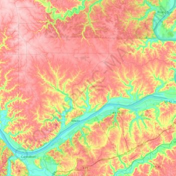
Name: Switzerland County topographic map, elevation, terrain.
Location: Switzerland County, Indiana, United States of America (38.68751 -85.20341 38.92942 -84.78461)
Average elevation: 225 m
Minimum elevation: 131 m
Maximum elevation: 301 m
Other topographic maps
Click on a map to view its topography, its elevation and its terrain.
Knightstown
United States of America > Indiana > Knightstown > Knightstown
Knightstown, Henry County, Indiana, United States of America
Average elevation: 285 m
Indianapolis
United States of America > Indiana > Indianapolis
Indianapolis, Marion, Indiana, United States of America
Average elevation: 241 m
Crows Nest
United States of America > Indiana > Crows Nest
Crows Nest, Marion County, Indiana, United States of America
Average elevation: 229 m