
Poste Romain topographic map
Interactive map
Click on the map to display elevation.
About this map
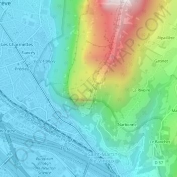
Name: Poste Romain topographic map, elevation, terrain.
Average elevation: 421 m
Minimum elevation: 204 m
Maximum elevation: 1,090 m
Other topographic maps
Click on a map to view its topography, its elevation and its terrain.
Le Souchet
France > Auvergne-Rhône-Alpes > Saint-Martin-le-Vinoux
Le Souchet, Saint-Martin-le-Vinoux, Grenoble, Isère, Auvergne-Rhône-Alpes, Metropolitan France, 38950, France
Average elevation: 753 m