
Moses Kotane Ward 13 topographic map
Interactive map
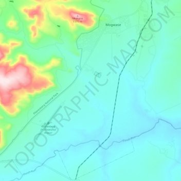
Click on the map to display elevation.
About this map
Name: Moses Kotane Ward 13 topographic map, elevation, terrain.
Average elevation: 1,074 m
Minimum elevation: 999 m
Maximum elevation: 1,406 m
Other topographic maps
Click on a map to view its topography, its elevation and its terrain.
Moses Kotane Local Municipality
RSA > North West > Moses Kotane Local Municipality
Moses Kotane Local Municipality, Bojanala Platinum District Municipality, North West, 0314, RSA
Average elevation: 1,084 m