
Thank you for supporting this site ❤️
Make a donation
Make a donation
Gear up for your next adventure:
As an Amazon Associate, this site earns from qualifying purchases at no extra cost to you.
Kuqa topographic map
Click on the map to display elevation.
Thank you for supporting this site ❤️
Make a donation
Make a donation
Gear up for your next adventure:
As an Amazon Associate, this site earns from qualifying purchases at no extra cost to you.
About this map
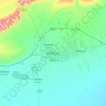
Name: Kuqa topographic map, elevation, terrain.
Location: Kuqa, Kuqa City, Aksu Prefecture, Xinjiang, China (41.55350 82.79443 41.87350 83.11443)
Average elevation: 1,107 m
Minimum elevation: 983 m
Maximum elevation: 1,831 m
Thank you for supporting this site ❤️
Make a donation
Make a donation
Gear up for your next adventure:
As an Amazon Associate, this site earns from qualifying purchases at no extra cost to you.