Geolocate

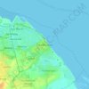
Brigsley topographic map

Click on the map to display elevation.

About this map

Name: Brigsley topographic map, elevation, terrain.

Location: Brigsley, North East Lincolnshire, Greater Lincolnshire, England, United Kingdom (53.48775 -0.12682 53.50905 -0.07334)

Average elevation: 23 m

Minimum elevation: 8 m

Maximum elevation: 70 m

Other topographic maps

Click on a map to view its topography, its elevation and its terrain.
Gear up for your next adventure:

🚰Portable Water Filters - Safely drink from Irish streams and mountain lakes
⛺Camping Tents - Top tents for Irish weather and conditions
⛺Ultralight Hiking Tents - Compact shelters for multi-day wild camping in Ireland
🎽Thermal Base Layers - Essential moisture management for cold weather
🌍Travel Adapters - Adapters for international travel

As an Amazon Associate, this site earns from qualifying purchases at no extra cost to you.