Geolocate

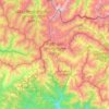
Koreti topographic map

Click on the map to display elevation.

About this map

Name: Koreti topographic map, elevation, terrain.

Location: Koreti, Akhmeta Municipality, Kakheti, 0900, Georgia (42.07557 45.23247 42.11557 45.27247)

Average elevation: 624 m

Minimum elevation: 538 m

Maximum elevation: 875 m

Other topographic maps

Click on a map to view its topography, its elevation and its terrain.
Gear up for your next adventure:

📈Fitness Trackers - Monitor activity and hike metrics
🧢Waterproof Caps - Keep rain off your face and glasses while hiking
🧿Outdoor Gadgets - Innovative tools for outdoor enthusiasts
🔦UV Flashlights - Search for minerals or inspect maps at night
🔨Multi-tool Devices - Versatile tools for gear repairs in the field

As an Amazon Associate, this site earns from qualifying purchases at no extra cost to you.