
Kyzylorda Region topographic map
Interactive map
Click on the map to display elevation.
About this map
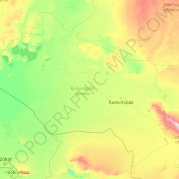
Name: Kyzylorda Region topographic map, elevation, terrain.
Location: Kyzylorda Region, Kazakhstan (42.32271 59.03060 47.82773 68.06030)
Average elevation: 153 m
Minimum elevation: 6 m
Maximum elevation: 1,512 m
Other topographic maps
Click on a map to view its topography, its elevation and its terrain.
Border Kazakhstan - Russia
Kazakhstan > East Kazakhstan Region > Katonkaragay District
Average elevation: 2,676 m