
Gemeinde Pinkafeld topographic map
Interactive map
Click on the map to display elevation.
About this map
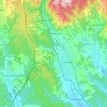
Name: Gemeinde Pinkafeld topographic map, elevation, terrain.
Location: Gemeinde Pinkafeld, Bezirk Oberwart, Burgenland, 7423, Austria (47.34203 16.05869 47.41477 16.15937)
Average elevation: 455 m
Minimum elevation: 363 m
Maximum elevation: 695 m