Geolocate

Provolt topographic map

Click on the map to display elevation.

About this map

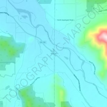
Name: Provolt topographic map, elevation, terrain.

Location: Provolt, Josephine County, Oregon, United States (42.26734 -123.25033 42.30734 -123.21033)

Average elevation: 394 m

Minimum elevation: 343 m

Maximum elevation: 764 m

Gear up for your next adventure:

Ultralight Hiking Tents - Compact shelters for multi-day wild camping in Ireland
🩹First Aid Kits - Essential kits for outdoor safety
🔋Solar Power Banks - Keep your GPS and phone charged in the Irish wilderness
🩹Compact First Aid Kits - Treat blisters and minor injuries on the trail
Solar Multisport Watches - Advanced mapping and GPS tracking for endurance hikers

As an Amazon Associate, this site earns from qualifying purchases at no extra cost to you.