
Thank you for supporting this site ❤️
Make a donation
Make a donation
Gear up for your next adventure:
As an Amazon Associate, this site earns from qualifying purchases at no extra cost to you.
’Ārue topographic map
Click on the map to display elevation.
Thank you for supporting this site ❤️
Make a donation
Make a donation
Gear up for your next adventure:
As an Amazon Associate, this site earns from qualifying purchases at no extra cost to you.
About this map
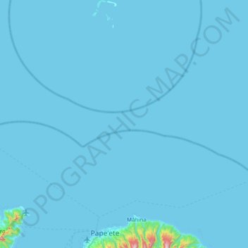
Name: ’Ārue topographic map, elevation, terrain.
Location: ’Ārue, Windward Islands, French Polynesia, 98701, France (-17.57414 -149.59672 -16.98406 -149.48794)
Average elevation: 14 m
Minimum elevation: 0 m
Maximum elevation: 1,263 m
Thank you for supporting this site ❤️
Make a donation
Make a donation
Gear up for your next adventure:
As an Amazon Associate, this site earns from qualifying purchases at no extra cost to you.