
West Yarmouth topographic map
Interactive map
Click on the map to display elevation.
About this map
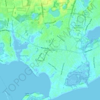
Name: West Yarmouth topographic map, elevation, terrain.
Average elevation: 4 m
Minimum elevation: -6 m
Maximum elevation: 16 m
Other topographic maps
Click on a map to view its topography, its elevation and its terrain.
South Yarmouth
United States > Massachusetts > Barnstable County > Yarmouth
South Yarmouth, Yarmouth, Barnstable County, Massachusetts, 02664, United States
Average elevation: 6 m