
Thank you for supporting this site ❤️
Make a donation
Make a donation
Gear up for your next adventure:
As an Amazon Associate, this site earns from qualifying purchases at no extra cost to you.
Godini topographic map
Click on the map to display elevation.
Thank you for supporting this site ❤️
Make a donation
Make a donation
Gear up for your next adventure:
As an Amazon Associate, this site earns from qualifying purchases at no extra cost to you.
About this map
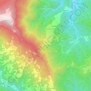
Name: Godini topographic map, elevation, terrain.
Location: Godini, Prarostino, Torino, Piedmont, 10065, Italy (44.84354 7.21523 44.88354 7.25523)
Average elevation: 916 m
Minimum elevation: 498 m
Maximum elevation: 1,511 m
Thank you for supporting this site ❤️
Make a donation
Make a donation
Gear up for your next adventure:
As an Amazon Associate, this site earns from qualifying purchases at no extra cost to you.