
Chiquimula topographic map
Interactive map
Click on the map to display elevation.
About this map
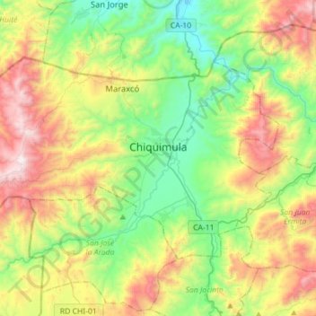
Name: Chiquimula topographic map, elevation, terrain.
Location: Chiquimula, Guatemala (14.70327 -89.72040 14.87809 -89.43768)
Average elevation: 780 m
Minimum elevation: 203 m
Maximum elevation: 1,807 m
Other topographic maps
Click on a map to view its topography, its elevation and its terrain.