

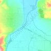
Elk Bend topographic map
Click on the map to display elevation.
About this map

Name: Elk Bend topographic map, elevation, terrain.
Location: Elk Bend, Lemhi County, Idaho, United States (44.87437 -113.97895 44.89437 -113.95895)
Average elevation: 1,437 m
Minimum elevation: 1,328 m
Maximum elevation: 1,662 m
Other topographic maps
Click on a map to view its topography, its elevation and its terrain.
Salmon
United States > Idaho > Lemhi County
Salmon is located at 45°10′41″N 113°54′10″W / 45.17806°N 113.90278°W / 45.17806; -113.90278 (45.178110, –113.902660). The elevation is 3,944 feet (1,202 m) above sea level.
Average elevation: 1,247 m
Salmon
United States > Idaho > Lemhi County
Salmon is located at 45°10′41″N 113°54′10″W / 45.17806°N 113.90278°W / 45.17806; -113.90278 (45.178110, –113.902660). The elevation is 3,944 feet (1,202 m) above sea level.
Average elevation: 1,247 m