Geolocate

Torpoint topographic map

Click on the map to display elevation.

About this map

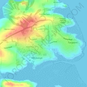
Name: Torpoint topographic map, elevation, terrain.

Location: Torpoint, Cornwall, England, United Kingdom (50.36347 -4.23736 50.38730 -4.19233)

Average elevation: 16 m

Minimum elevation: -1 m

Maximum elevation: 59 m

Other topographic maps

Click on a map to view its topography, its elevation and its terrain.

Cremyll

United Kingdom > England > Cornwall > Torpoint

Average elevation: 19 m

Gear up for your next adventure:

🧢Waterproof Caps - Keep rain off your face and glasses while hiking
🧴Long-Lasting Sunscreen - Protect against UV rays during long days on the ridges
📍Handheld GPS Devices - Accurate GPS units for mapping and navigation
🔋Portable Power Banks - Keep devices charged on long trips
🛌3-Season Sleeping Bags - Comfortable insulation for Irish spring and autumn nights

As an Amazon Associate, this site earns from qualifying purchases at no extra cost to you.