
Pioneer Weapons Wildlife Management Area topographic map
Interactive map
Click on the map to display elevation.
About this map
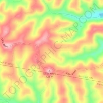
Name: Pioneer Weapons Wildlife Management Area topographic map, elevation, terrain.
Average elevation: 323 m
Minimum elevation: 223 m
Maximum elevation: 390 m
Other topographic maps
Click on a map to view its topography, its elevation and its terrain.
Sharpsburg
United States > Kentucky > Bath County
Sharpsburg, Bath County, Kentucky, United States
Average elevation: 297 m
Olympia
United States > Kentucky > Bath County
Olympia, Bath County, Kentucky, 40358, United States
Average elevation: 248 m
Owingsville
United States > Kentucky > Bath County
Owingsville, Bath County, Kentucky, 40360, United States
Average elevation: 262 m
Salt Lick
United States > Kentucky > Bath County
Salt Lick, Bath County, Kentucky, United States
Average elevation: 217 m