
Becerreá topographic map
Interactive map
Click on the map to display elevation.
About this map
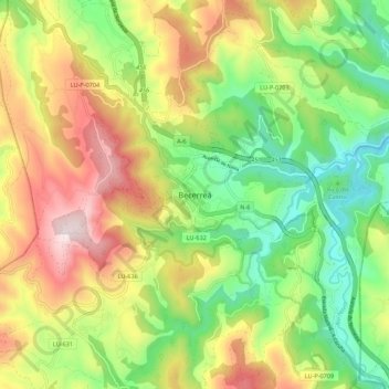
Name: Becerreá topographic map, elevation, terrain.
Location: Becerreá, Ancares, Lugo, Galicia, 27640, España (42.81450 -7.20160 42.89450 -7.12160)
Average elevation: 733 m
Minimum elevation: 406 m
Maximum elevation: 1,173 m