
Embleton topographic map
Interactive map
Click on the map to display elevation.
About this map
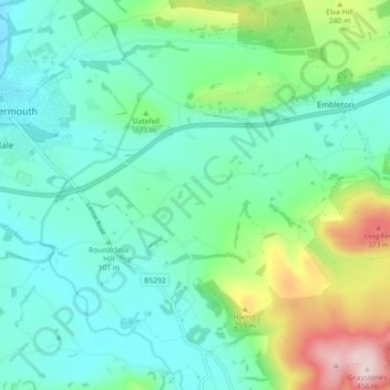
Name: Embleton topographic map, elevation, terrain.
Location: Embleton, Allerdale, Cumbria, England, United Kingdom (54.62986 -3.35126 54.67038 -3.26083)
Average elevation: 144 m
Minimum elevation: 44 m
Maximum elevation: 455 m
Other topographic maps
Click on a map to view its topography, its elevation and its terrain.
Spittal Rigg
United Kingdom > England > Cumbria > Allerdale > Dockray
Spittal Rigg, Dockray, Woodside, Allerdale, Cumbria, England, CA7 0ES, United Kingdom
Average elevation: 29 m
Maryport
United Kingdom > England > Cumbria > Allerdale
Maryport, Allerdale, Cumbria, North West England, England, United Kingdom
Average elevation: 40 m