
Thank you for supporting this site ❤️
Make a donation
Make a donation
Gear up for your next adventure:
As an Amazon Associate, this site earns from qualifying purchases at no extra cost to you.
Hiraizumi topographic map
Click on the map to display elevation.
Thank you for supporting this site ❤️
Make a donation
Make a donation
Gear up for your next adventure:
As an Amazon Associate, this site earns from qualifying purchases at no extra cost to you.
About this map
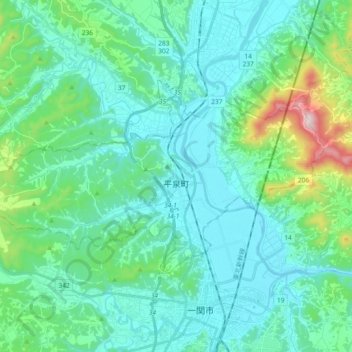
Name: Hiraizumi topographic map, elevation, terrain.
Location: Hiraizumi, Nishiiwai County, Iwate Prefecture, Japan (38.94960 141.00643 39.02880 141.19207)
Average elevation: 107 m
Minimum elevation: 9 m
Maximum elevation: 581 m
Thank you for supporting this site ❤️
Make a donation
Make a donation
Gear up for your next adventure:
As an Amazon Associate, this site earns from qualifying purchases at no extra cost to you.