Geolocate

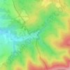
Telnice topographic map

Click on the map to display elevation.

About this map

Name: Telnice topographic map, elevation, terrain.

Location: Telnice, okres Brno-venkov, South Moravian Region, 664 59, Czechia (49.08751 16.68184 49.11307 16.73652)

Average elevation: 198 m

Minimum elevation: 183 m

Maximum elevation: 229 m

Other topographic maps

Click on a map to view its topography, its elevation and its terrain.

Hnízdo

Czechia > South Moravian Region

Average elevation: 232 m

Vápenky

Czechia > South Moravian Region > Nová Lhota

Average elevation: 578 m

Gear up for your next adventure:

🚰Hydration Packs - Hands‑free water storage for hikers
🚰Portable Water Filters - Safely drink from Irish streams and mountain lakes
🗺️Topographic Maps - Detailed maps for hiking, cycling and planning routes
🕶️Polarized Sunglasses - Reduce glare outdoors
🧢Waterproof Caps - Keep rain off your face and glasses while hiking

As an Amazon Associate, this site earns from qualifying purchases at no extra cost to you.