
乌尔禾镇 topographic map
Interactive map
Click on the map to display elevation.
About this map
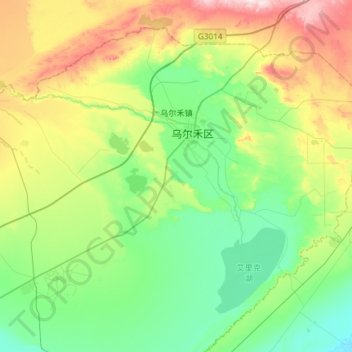
Name: 乌尔禾镇 topographic map, elevation, terrain.
Location: 乌尔禾镇, 乌尔禾区, 克拉玛依市, 新疆维吾尔自治区, 中国 (45.86417 85.42991 46.21157 86.02171)
Average elevation: 359 m
Minimum elevation: 248 m
Maximum elevation: 659 m
Other topographic maps
Click on a map to view its topography, its elevation and its terrain.