Geolocate

Pachna topographic map

Click on the map to display elevation.

About this map
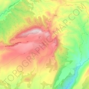
Name: Pachna topographic map, elevation, terrain.

Location: Pachna, Limassol District, Cyprus, 4700, Cyprus (34.75659 32.77297 34.79659 32.81297)

Average elevation: 592 m

Minimum elevation: 373 m

Maximum elevation: 775 m

Gear up for your next adventure:

🧊Hydration Reservoirs - Easy drinking on the move with 2L or 3L bladders
🌿Irish Flora Guides - Identify plants while exploring the countryside
⌚Smart Watches for Hiking - Track performance on trails
🎒Backpack Rain Covers - Extra protection for non-waterproof rucksacks
🪶Down Jackets - Warm jackets for cold outdoor trips

As an Amazon Associate, this site earns from qualifying purchases at no extra cost to you.