Geolocate

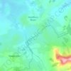
Hazelbury Bryan topographic map

Click on the map to display elevation.

About this map

Name: Hazelbury Bryan topographic map, elevation, terrain.

Location: Hazelbury Bryan, Dorset, England, United Kingdom (50.86208 -2.38940 50.89555 -2.32343)

Average elevation: 91 m

Minimum elevation: 61 m

Maximum elevation: 181 m

Other topographic maps

Click on a map to view its topography, its elevation and its terrain.

Kingston

United Kingdom > England > Dorset > Hazelbury Bryan

Average elevation: 85 m

Parkgate

United Kingdom > England > Dorset > Hazelbury Bryan > Parkgate

Average elevation: 105 m

Gear up for your next adventure:

🩹First Aid Kits - Essential kits for outdoor safety
🔌Fast Car Chargers - Recharge GPS and phones between trailheads
🎒Day Packs - Perfect packs for day trips
🛶Kayaking & Water Sports Gear - Equip for water adventures
🔨Multi-tool Devices - Versatile tools for gear repairs in the field

As an Amazon Associate, this site earns from qualifying purchases at no extra cost to you.