
Thank you for supporting this site ❤️
Make a donation
Make a donation
Gear up for your next adventure:
As an Amazon Associate, this site earns from qualifying purchases at no extra cost to you.
Yangyuan topographic map
Click on the map to display elevation.
Thank you for supporting this site ❤️
Make a donation
Make a donation
Gear up for your next adventure:
As an Amazon Associate, this site earns from qualifying purchases at no extra cost to you.
About this map
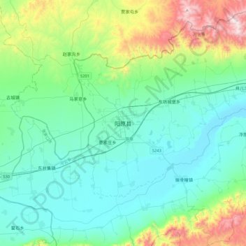
Name: Yangyuan topographic map, elevation, terrain.
Location: Yangyuan, Zhangjiakou City, Hebei, China (39.94247 113.98375 40.26247 114.30375)
Average elevation: 1,090 m
Minimum elevation: 841 m
Maximum elevation: 2,031 m
Thank you for supporting this site ❤️
Make a donation
Make a donation
Gear up for your next adventure:
As an Amazon Associate, this site earns from qualifying purchases at no extra cost to you.