
Thank you for supporting this site ❤️
Make a donation
Make a donation
Gear up for your next adventure:
As an Amazon Associate, this site earns from qualifying purchases at no extra cost to you.
Wall topographic map
Click on the map to display elevation.
Thank you for supporting this site ❤️
Make a donation
Make a donation
Gear up for your next adventure:
As an Amazon Associate, this site earns from qualifying purchases at no extra cost to you.
About this map
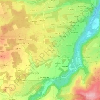
Name: Wall topographic map, elevation, terrain.
Location: Wall, Warngau, Landkreis Miesbach, Bayern, 83627, Deutschland (47.76921 11.75061 47.80921 11.79061)
Average elevation: 734 m
Minimum elevation: 644 m
Maximum elevation: 822 m
Thank you for supporting this site ❤️
Make a donation
Make a donation
Gear up for your next adventure:
As an Amazon Associate, this site earns from qualifying purchases at no extra cost to you.