
Thank you for supporting this site ❤️
Make a donation
Make a donation
Gear up for your next adventure:
As an Amazon Associate, this site earns from qualifying purchases at no extra cost to you.
Lighezzoli topographic map
Click on the map to display elevation.
Thank you for supporting this site ❤️
Make a donation
Make a donation
Gear up for your next adventure:
As an Amazon Associate, this site earns from qualifying purchases at no extra cost to you.
About this map
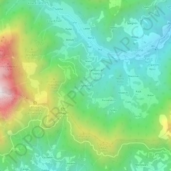
Name: Lighezzoli topographic map, elevation, terrain.
Location: Lighezzoli, Posina, Vicenza, Veneto, 36010, Italia (45.76276 11.22487 45.80276 11.26487)
Average elevation: 883 m
Minimum elevation: 498 m
Maximum elevation: 1,774 m
Thank you for supporting this site ❤️
Make a donation
Make a donation
Gear up for your next adventure:
As an Amazon Associate, this site earns from qualifying purchases at no extra cost to you.