Geolocate

Gallatin topographic map

Click on the map to display elevation.

About this map
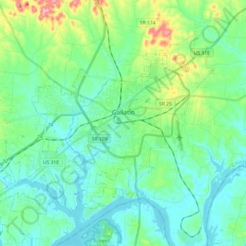
Name: Gallatin topographic map, elevation, terrain.

Location: Gallatin, Sumner County, Middle Tennessee, Tennessee, 37066, United States (36.33097 -86.55470 36.43343 -86.38357)

Average elevation: 166 m

Minimum elevation: 135 m

Maximum elevation: 275 m

Other topographic maps

Click on a map to view its topography, its elevation and its terrain.

Bethpage

United States > Tennessee > Sumner County

Average elevation: 193 m

Oak Grove

United States > Tennessee > Sumner County

Average elevation: 256 m

Gear up for your next adventure:

🥣Outdoor Food & Meals - Dehydrated meals for backpacking
🚲Cycling GPS Computers - Topographic mapping for Irish road and mountain biking
🔗Locking Carabiners - Secure gear to your pack or for light climbing
🌲Bushcraft Skills Books - Learn navigation, fire-making, and shelter building
🥛Insulated Flasks - Keep drinks hot or cold

As an Amazon Associate, this site earns from qualifying purchases at no extra cost to you.