
設樂町 topographic map
Interactive map
Click on the map to display elevation.
About this map
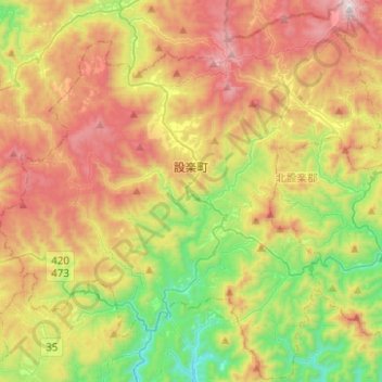
Name: 設樂町 topographic map, elevation, terrain.
Location: 設樂町, 北設樂郡, 爱知县, 中部地方, 441-2601, 日本 (35.01633 137.42926 35.21755 137.67811)
Average elevation: 683 m
Minimum elevation: 149 m
Maximum elevation: 1,352 m