
Thank you for supporting this site ❤️
Make a donation
Make a donation
Gear up for your next adventure:
As an Amazon Associate, this site earns from qualifying purchases at no extra cost to you.
Igtuble topographic map
Click on the map to display elevation.
Thank you for supporting this site ❤️
Make a donation
Make a donation
Gear up for your next adventure:
As an Amazon Associate, this site earns from qualifying purchases at no extra cost to you.
About this map
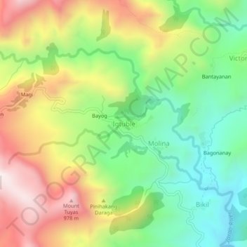
Name: Igtuble topographic map, elevation, terrain.
Location: Igtuble, Tubungan, Iloilo, Western Visayas, Philippines (10.80489 122.24712 10.84489 122.28712)
Average elevation: 548 m
Minimum elevation: 167 m
Maximum elevation: 1,059 m
Thank you for supporting this site ❤️
Make a donation
Make a donation
Gear up for your next adventure:
As an Amazon Associate, this site earns from qualifying purchases at no extra cost to you.