
Peyrilhac topographic map
Interactive map
Click on the map to display elevation.
About this map
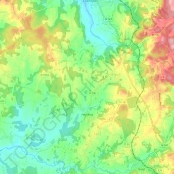
Name: Peyrilhac topographic map, elevation, terrain.
Average elevation: 313 m
Minimum elevation: 249 m
Maximum elevation: 416 m
Other topographic maps
Click on a map to view its topography, its elevation and its terrain.
Curebouteille
France > Nouvelle-Aquitaine > Haute-Vienne > Oradour-sur-Vayres
Average elevation: 312 m