
瓦塘镇 topographic map
Interactive map
Click on the map to display elevation.
About this map
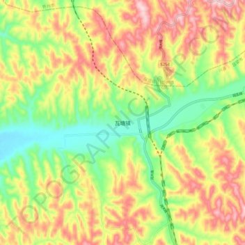
Name: 瓦塘镇 topographic map, elevation, terrain.
Location: 瓦塘镇, 兴县, 吕梁市, 山西省, 中国 (38.60681 110.95210 38.68681 111.03210)
Average elevation: 973 m
Minimum elevation: 827 m
Maximum elevation: 1,137 m