
Cody topographic map
Interactive map
Click on the map to display elevation.
About this map
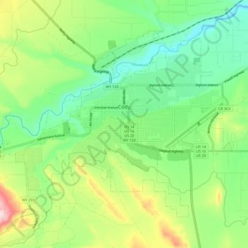
Name: Cody topographic map, elevation, terrain.
Location: Cody, Park County, Wyoming, United States of America (44.48981 -109.12048 44.55131 -109.00576)
Average elevation: 1,557 m
Minimum elevation: 1,436 m
Maximum elevation: 1,798 m
Cody's elevation is about 5016 ft (1,500 m) above sea level. The main part of the city is split across three levels, separated by about 60 feet (18 m).