
Morowali Utara topographic map
Interactive map
Click on the map to display elevation.
About this map
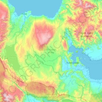
Name: Morowali Utara topographic map, elevation, terrain.
Location: Morowali Utara, Central Sulawesi, 94971, Indonesia (-2.41049 120.82985 -1.27327 122.05843)
Average elevation: 708 m
Minimum elevation: -2 m
Maximum elevation: 2,977 m
Other topographic maps
Click on a map to view its topography, its elevation and its terrain.