
Make a donation
Gear up for your next adventure:
As an Amazon Associate, this site earns from qualifying purchases at no extra cost to you.
Kampung Serada topographic map
Click on the map to display elevation.
Make a donation
Gear up for your next adventure:
As an Amazon Associate, this site earns from qualifying purchases at no extra cost to you.
About this map
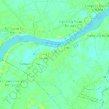
Name: Kampung Serada topographic map, elevation, terrain.
Location: Kampung Serada, Kuala Terengganu, Terengganu, 20050, Malaysia (5.24224 103.03839 5.28224 103.07839)
Average elevation: 7 m
Minimum elevation: 0 m
Maximum elevation: 17 m
Make a donation
Gear up for your next adventure:
As an Amazon Associate, this site earns from qualifying purchases at no extra cost to you.
Other topographic maps
Click on a map to view its topography, its elevation and its terrain.
Duyung Small Island
Malaysia > Terengganu > Kuala Terengganu > Kuala Terengganu
Average elevation: 4 m
Make a donation
Gear up for your next adventure:
As an Amazon Associate, this site earns from qualifying purchases at no extra cost to you.
Pak Mat Lebai Island
Malaysia > Terengganu > Kuala Terengganu > Kuala Terengganu
Average elevation: 6 m
Make a donation
Gear up for your next adventure:
As an Amazon Associate, this site earns from qualifying purchases at no extra cost to you.
Batu Burok Public Park
Malaysia > Terengganu > Kuala Terengganu > Kuala Terengganu
Average elevation: 5 m
Taman Tamadun Islam (Mini Islam)
Malaysia > Terengganu > Kuala Terengganu > Kuala Terengganu
Average elevation: 5 m