Geolocate

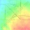
Rogerson topographic map

Click on the map to display elevation.

About this map

Name: Rogerson topographic map, elevation, terrain.

Location: Rogerson, Twin Falls County, Idaho, United States (42.19797 -114.61420 42.23797 -114.57420)

Average elevation: 1,498 m

Minimum elevation: 1,462 m

Maximum elevation: 1,552 m

Other topographic maps

Click on a map to view its topography, its elevation and its terrain.

Twin Falls

United States > Idaho > Twin Falls County

Average elevation: 1,138 m

Twin Falls

United States > Idaho > Twin Falls County

Average elevation: 1,138 m

Buhl

United States > Idaho > Twin Falls County

Average elevation: 1,149 m

Twin Falls

United States > Idaho > Twin Falls County

Average elevation: 1,138 m

Gear up for your next adventure:

🔥Camping Stoves - Portable camping stoves for outdoor cooking
🧥Gore-Tex Rain Jackets - Breathable and fully waterproof shells for Irish weather
🧴Long-Lasting Sunscreen - Protect against UV rays during long days on the ridges
🧭Route Planning Books - Plan the best hiking routes
🪶Ultralight Tents - Lightweight shelters for hikers

As an Amazon Associate, this site earns from qualifying purchases at no extra cost to you.