
Thank you for supporting this site ❤️
Make a donation
Make a donation
Gear up for your next adventure:
As an Amazon Associate, this site earns from qualifying purchases at no extra cost to you.
Zeetze topographic map
Click on the map to display elevation.
Thank you for supporting this site ❤️
Make a donation
Make a donation
Gear up for your next adventure:
As an Amazon Associate, this site earns from qualifying purchases at no extra cost to you.
About this map
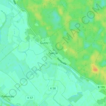
Name: Zeetze topographic map, elevation, terrain.
Location: Zeetze, Amt Neuhaus, Lüneburg, Lower Saxony, Germany (53.20900 10.96583 53.24900 11.00583)
Average elevation: 13 m
Minimum elevation: 5 m
Maximum elevation: 31 m
Thank you for supporting this site ❤️
Make a donation
Make a donation
Gear up for your next adventure:
As an Amazon Associate, this site earns from qualifying purchases at no extra cost to you.