
Thank you for supporting this site ❤️
Make a donation
Make a donation
Gear up for your next adventure:
As an Amazon Associate, this site earns from qualifying purchases at no extra cost to you.
Mohali topographic map
Click on the map to display elevation.
Thank you for supporting this site ❤️
Make a donation
Make a donation
Gear up for your next adventure:
As an Amazon Associate, this site earns from qualifying purchases at no extra cost to you.
About this map
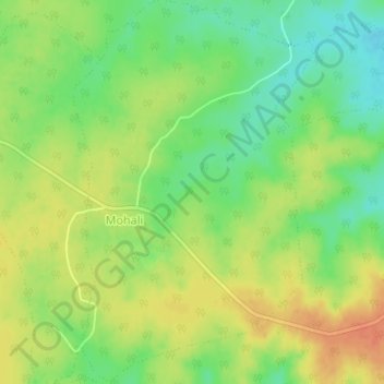
Name: Mohali topographic map, elevation, terrain.
Location: Mohali, Rehli Tahsil, Sagar, Madhya Pradesh, India (23.51491 79.22031 23.54831 79.24315)
Average elevation: 430 m
Minimum elevation: 409 m
Maximum elevation: 450 m
Thank you for supporting this site ❤️
Make a donation
Make a donation
Gear up for your next adventure:
As an Amazon Associate, this site earns from qualifying purchases at no extra cost to you.