Geolocate

Buenos topographic map

Click on the map to display elevation.

About this map
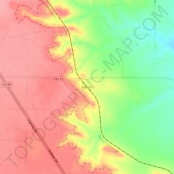
Name: Buenos topographic map, elevation, terrain.

Location: Buenos, Garza County, Texas, United States (33.27926 -101.50765 33.31926 -101.46765)

Average elevation: 876 m

Minimum elevation: 815 m

Maximum elevation: 916 m

Other topographic maps

Click on a map to view its topography, its elevation and its terrain.
Post

United States > Texas > Garza County

Average elevation: 793 m

Gear up for your next adventure:

🔦LED Flashlights - Bright, durable flashlights for outdoor use
🌲Bushcraft Skills Books - Learn navigation, fire-making, and shelter building
🛸Lightweight Camera Drones - Capture stunning aerial topographic views of the landscape
🧥Waterproof Hiking Jackets - Rain jackets for unpredictable weather
🧦Merino Wool Socks - Moisture-wicking and blister-preventing trail socks

As an Amazon Associate, this site earns from qualifying purchases at no extra cost to you.