
Jeddingen topographic map
Interactive map
Click on the map to display elevation.
About this map
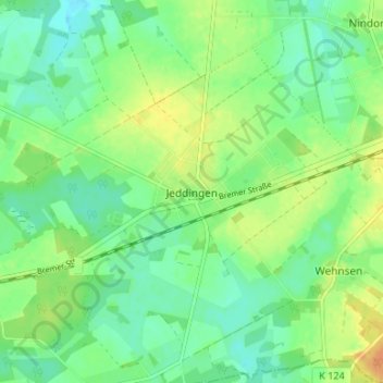
Name: Jeddingen topographic map, elevation, terrain.
Average elevation: 54 m
Minimum elevation: 42 m
Maximum elevation: 72 m
Other topographic maps
Click on a map to view its topography, its elevation and its terrain.
Hiddingen
Deutschland > Niedersachsen > Landkreis Rotenburg (Wümme) > Visselhövede
Hiddingen, Visselhövede, Landkreis Rotenburg (Wümme), Niedersachsen, 27374, Deutschland
Average elevation: 62 m
Wehnsen
Deutschland > Niedersachsen > Landkreis Rotenburg (Wümme) > Visselhövede > Wehnsen
Wehnsen, Visselhövede, Landkreis Rotenburg (Wümme), Niedersachsen, 27374, Deutschland
Average elevation: 58 m