
Thank you for supporting this site ❤️
Make a donation
Make a donation
Gear up for your next adventure:
As an Amazon Associate, this site earns from qualifying purchases at no extra cost to you.
Olivenza topographic map
Click on the map to display elevation.
Thank you for supporting this site ❤️
Make a donation
Make a donation
Gear up for your next adventure:
As an Amazon Associate, this site earns from qualifying purchases at no extra cost to you.
About this map
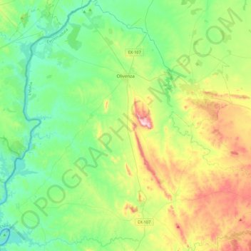
Name: Olivenza topographic map, elevation, terrain.
Location: Olivenza, Llanos de Olivenza, Badajoz, Extremadura, Spain (38.45387 -7.27251 38.78559 -6.95268)
Average elevation: 257 m
Minimum elevation: 116 m
Maximum elevation: 597 m
Thank you for supporting this site ❤️
Make a donation
Make a donation
Gear up for your next adventure:
As an Amazon Associate, this site earns from qualifying purchases at no extra cost to you.