Geolocate

Spring Valley topographic map

Click on the map to display elevation.

About this map
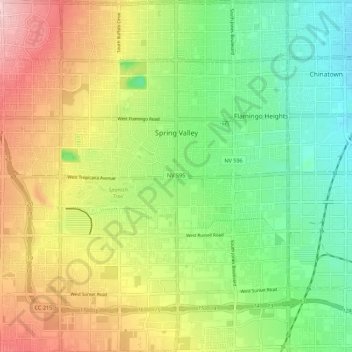
Name: Spring Valley topographic map, elevation, terrain.

Location: Spring Valley, Clark County, Nevada, United States (36.02796 -115.31578 36.14453 -115.20788)

Average elevation: 777 m

Minimum elevation: 656 m

Maximum elevation: 1,070 m

Gear up for your next adventure:

🎽Thermal Base Layers - Essential moisture management for cold weather
🧤Thermal Outdoor Gloves - Windproof and waterproof gloves for winter hiking
🎒Hiking Backpacks - Durable backpacks for day hikes and multi‑day treks
🔨Multi-tool Devices - Versatile tools for gear repairs in the field
🛡️Protective Bike Gear - Helmets & pads for safe rides

As an Amazon Associate, this site earns from qualifying purchases at no extra cost to you.