
Tempo topographic map
Interactive map
Click on the map to display elevation.
About this map
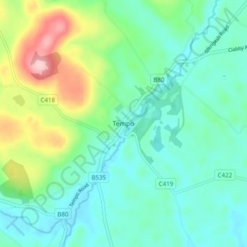
Name: Tempo topographic map, elevation, terrain.
Average elevation: 127 m
Minimum elevation: 79 m
Maximum elevation: 264 m
Other topographic maps
Click on a map to view its topography, its elevation and its terrain.
Belcoo
United Kingdom > Northern Ireland > County Fermanagh
Belcoo, County Fermanagh, Ulster, Northern Ireland, BT93 5FB, United Kingdom
Average elevation: 86 m
Moher
United Kingdom > Northern Ireland > County Fermanagh
Moher, Lea, County Fermanagh, Ulster, Northern Ireland, BT92 4FJ, United Kingdom
Average elevation: 65 m
Horse Island
United Kingdom > Northern Ireland > County Fermanagh
Horse Island, County Fermanagh, Ulster, Northern Ireland, United Kingdom
Average elevation: 46 m
Heron Island
United Kingdom > Northern Ireland > County Fermanagh
Heron Island, County Fermanagh, Ulster, Northern Ireland, United Kingdom
Average elevation: 47 m