
Thank you for supporting this site ❤️
Make a donation
Make a donation
Gear up for your next adventure:
As an Amazon Associate, this site earns from qualifying purchases at no extra cost to you.
Preston topographic map
Click on the map to display elevation.
Thank you for supporting this site ❤️
Make a donation
Make a donation
Gear up for your next adventure:
As an Amazon Associate, this site earns from qualifying purchases at no extra cost to you.
About this map
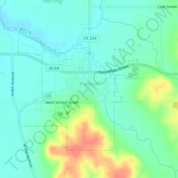
Name: Preston topographic map, elevation, terrain.
Location: Preston, Jackson County, Iowa, 52069, United States (42.04070 -90.40863 42.05932 -90.38404)
Average elevation: 207 m
Minimum elevation: 191 m
Maximum elevation: 245 m
Thank you for supporting this site ❤️
Make a donation
Make a donation
Gear up for your next adventure:
As an Amazon Associate, this site earns from qualifying purchases at no extra cost to you.
Other topographic maps
Click on a map to view its topography, its elevation and its terrain.
Springbrook
United States > Iowa > Jackson County > Springbrook > Springbrook
Average elevation: 246 m