
Make a donation
Gear up for your next adventure:
As an Amazon Associate, this site earns from qualifying purchases at no extra cost to you.
Sant Rafel de sa Creu topographic map
Click on the map to display elevation.
Make a donation
Gear up for your next adventure:
As an Amazon Associate, this site earns from qualifying purchases at no extra cost to you.
About this map
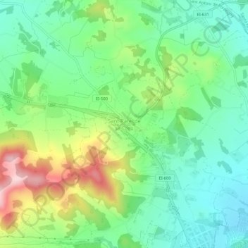
Name: Sant Rafel de sa Creu topographic map, elevation, terrain.
Average elevation: 114 m
Minimum elevation: 25 m
Maximum elevation: 291 m
Make a donation
Gear up for your next adventure:
As an Amazon Associate, this site earns from qualifying purchases at no extra cost to you.
Other topographic maps
Click on a map to view its topography, its elevation and its terrain.
Paseo Marítimo de la Bahia de Sant Antoni de Portmany
Spain > Balearic Islands > Ibiza > Sant Antoni de Portmany
Average elevation: 11 m
Make a donation
Gear up for your next adventure:
As an Amazon Associate, this site earns from qualifying purchases at no extra cost to you.
Cala Grassio
Spain > Balearic Islands > Ibiza > Sant Antoni de Portmany > Can Germà > Cap Negret
Average elevation: 23 m