
Pasuruan topographic map
Interactive map
Click on the map to display elevation.
About this map
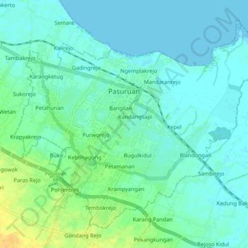
Name: Pasuruan topographic map, elevation, terrain.
Location: Pasuruan, East Java, Indonesia (-7.68651 112.86827 -7.61777 112.95276)
Average elevation: 7 m
Minimum elevation: -2 m
Maximum elevation: 27 m
Other topographic maps
Click on a map to view its topography, its elevation and its terrain.