
Rogers Park topographic map
Interactive map
Click on the map to display elevation.
About this map
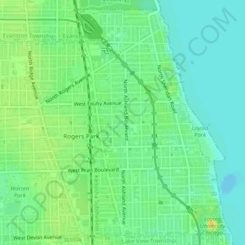
Name: Rogers Park topographic map, elevation, terrain.
Location: Rogers Park, Chicago, Cook County, Illinois, USA (41.99796 -87.68465 42.02304 -87.65456)
Average elevation: 183 m
Minimum elevation: 172 m
Maximum elevation: 199 m
Other topographic maps
Click on a map to view its topography, its elevation and its terrain.
Garfield Ridge
Garfield Ridge, Chicago, Cook County, Illinois, USA
Average elevation: 184 m
Forest Glen
Forest Glen, Chicago, Cook County, Illinois, 60646, USA
Average elevation: 188 m