
Leintwardine topographic map
Interactive map
Click on the map to display elevation.
About this map
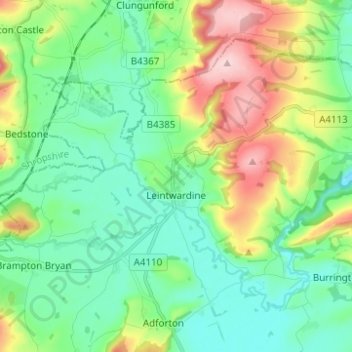
Name: Leintwardine topographic map, elevation, terrain.
Location: Leintwardine, Herefordshire, England, United Kingdom (52.33637 -2.92250 52.39549 -2.79865)
Average elevation: 162 m
Minimum elevation: 101 m
Maximum elevation: 305 m