
Xã Phước Tín topographic map
Interactive map
Click on the map to display elevation.
About this map
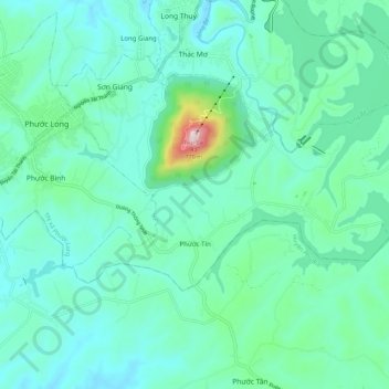
Name: Xã Phước Tín topographic map, elevation, terrain.
Location: Xã Phước Tín, Phước Long, Bình Phước Province, Vietnam (11.77449 106.96527 11.82780 107.07541)
Average elevation: 214 m
Minimum elevation: 114 m
Maximum elevation: 712 m
Other topographic maps
Click on a map to view its topography, its elevation and its terrain.
Phước Long
Vietnam > Bình Phước Province > Phước Long
Phước Long, Bình Phước Province, Vietnam
Average elevation: 202 m