
Lomo Plata topographic map
Interactive map
Click on the map to display elevation.
About this map
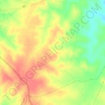
Name: Lomo Plata topographic map, elevation, terrain.
Location: Lomo Plata, La Coronada, Badajoz, Extremadura, 06460, Spain (38.90108 -5.65789 38.92108 -5.63789)
Average elevation: 367 m
Minimum elevation: 332 m
Maximum elevation: 391 m