
Thank you for supporting this site ❤️
Make a donation
Make a donation
Gear up for your next adventure:
As an Amazon Associate, this site earns from qualifying purchases at no extra cost to you.
Mattersburg topographic map
Click on the map to display elevation.
Thank you for supporting this site ❤️
Make a donation
Make a donation
Gear up for your next adventure:
As an Amazon Associate, this site earns from qualifying purchases at no extra cost to you.
About this map
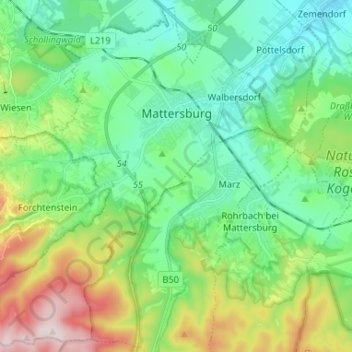
Name: Mattersburg topographic map, elevation, terrain.
Location: Mattersburg, Bezirk Mattersburg, Burgenland, 7210, Austria (47.67852 16.30904 47.76329 16.44012)
Average elevation: 332 m
Minimum elevation: 195 m
Maximum elevation: 674 m
Thank you for supporting this site ❤️
Make a donation
Make a donation
Gear up for your next adventure:
As an Amazon Associate, this site earns from qualifying purchases at no extra cost to you.